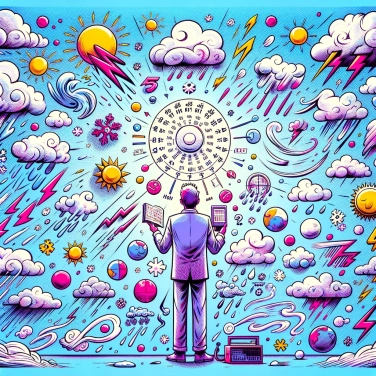
Weather is difficult to predict accurately due to the complexity of interactions between various atmospheric phenomena, such as atmospheric pressure, temperature, humidity, and air currents, which can change rapidly and unpredictably.
The weather depends on simple initial conditions: temperature, pressure, or wind at a specific moment. The problem is that a tiny fluctuation in any of these can quickly lead to a huge change in forecasts a few days later. This is called the butterfly effect: a simple flap of a butterfly's wings can lead to unexpected and disproportionate consequences elsewhere on the globe. That’s why, even with ultra-precise information at the outset, tiny variations that are impossible to measure quickly become unmanageable, and weather forecasts lose reliability after just a few days.
The atmosphere is a real mess, full of different elements interacting with each other: warm air and cold air, humidity, suspended particles, and atmospheric pressure. All of this moves, collides, forming currents, clouds, and precipitation. A small variation in one place can lead to cascading effects on the other side of the globe. It's like a gigantic three-dimensional game of billiards: we know the general rules, but precisely anticipating each interaction is another story.
Even with our advanced radars, satellites, and cutting-edge instruments, accurately predicting the weather remains a challenge. Weather satellites, for instance, cover a large area but often lack fine details, especially in small local zones. Moreover, some instruments are not perfect: measurements of temperature, humidity, or wind speed always have a margin of error, however small, which tends to worsen over time. Not to mention that our observation systems have gaps, particularly in remote, oceanic, or mountainous regions: inevitably, this limits the accuracy of overall forecasts. Another issue is that despite the powerful computing capabilities of supercomputers, they still struggle to process all the collected data quickly enough. As a result, forecasts remain approximate when extending beyond a few days.
Weather models are computer simulations that attempt to predict how the atmosphere will evolve based on collected data. Even though they are becoming increasingly accurate, no model is perfect yet. Why? Because to generate a forecast, the atmosphere is divided into small sections called grid points, where calculations are made separately. However, these grid points do not always capture very localized phenomena such as light showers, thunderstorms, or gusts of wind. As a result, some important information slips through the cracks, literally! Moreover, initial errors, even if small, accumulate and grow over time, quickly reducing the reliability of long-term forecasts. We then end up with a weather report that differs from what is actually hitting our window.
Weather phenomena are governed by precise physical laws, yet they often remain unpredictable due to their chaotic nature. It's a bit like a billiard cue: if the initial shot varies slightly, the final trajectories can change completely. In weather, a small local variation, even minute, can cause a significant difference a few days later. This is called the butterfly effect: a tiny change – like the flap of a butterfly's wings – could completely redistribute the weather patterns on the other side of the world. And this is complicated to manage for meteorologists. Even with advanced tools, accurately predicting this chaos is almost an impossible challenge.
The theory of chaos, popularized by the image of a butterfly's wing flap potentially triggering a tornado on the other side of the world, actually illustrates the exceptional difficulty in accurately predicting weather phenomena.
The first known weather report dates back to 1861 in England, and even at that time, forecasters had observed how challenging it was to provide accurate forecasts beyond one or two days.
A single thunderstorm can require as much energy as the explosion of several atomic bombs, highlighting how powerful and unpredictable weather phenomena can be.
Modern weather forecasts are derived from complex calculations performed by supercomputers capable of executing billions of calculations per second, but even these ultra-powerful machines face limitations when confronted with the chaotic nature of the climate.
Some recent advancements, such as powerful supercomputers, next-generation weather satellites, and artificial intelligence techniques designed to better analyze the vast volumes of atmospheric data, are slowly but surely improving the reliability of weather forecasts.
Forecasts can vary depending on the sources, as they use different models, techniques, datasets, and processing criteria. Each provider has its own methodology, which explains why slightly different forecasts can be observed for the same location and time period.
Sure! Here’s the translation: "Yes. In general, computers quickly process a vast amount of data and effectively identify numerical patterns, but human meteorologists can provide essential expertise by analyzing specific contexts, assessing the reliability of different models, and adjusting their forecasts based on their practical experience and knowledge of local phenomena."
Climate change affects the accuracy of weather forecasts by creating more frequent extreme weather events and altering existing weather patterns. These anomalies make it more challenging to create and accurately adjust computer models, leading to an increase in uncertainty.
Some brief and highly localized weather events, such as sudden storms, tornadoes, or hail, are particularly difficult to predict accurately due to their rapidly changing nature and the small spatial scales at which they occur.
Long-term weather forecasts become less reliable due to the chaotic nature and complex interactions of the atmosphere. As the time frame extends, small initial errors in weather models multiply, leading to increased uncertainty in the final outcomes.

No one has answered this quiz yet, be the first!' :-)
Question 1/5