Tornadoes often form after strong heat because excessive heat promotes unstable weather conditions, with masses of warm air rising rapidly and meeting masses of cold air, creating violent whirlwinds.
When it is very hot, the ground stores a lot of heat. It then heats the air at the surface, creating a layer of warm air that rises quickly because it is lighter than the colder air above. This rapid ascent creates intense vertical movements, known as strong atmospheric instability. All this rising warm air encounters colder air at higher altitudes, which further accelerates the ascent (a bit like a bubble of warm air quickly rising in a colder fluid!). The more intense these vertical currents become due to the heat, the more chaotic the atmosphere becomes, creating favorable conditions for the development of powerful thunderstorm clouds, the initial stage in the formation of tornadoes.
After a strong heat, the warm air at the surface rises quickly because it is lighter. It suddenly encounters the cold air coming from elsewhere, often from higher altitudes or arriving quickly from the side. This clash creates a zone where these very different air masses collide sharply, which increases the instability in the atmosphere. This encounter forms what is called a front, a kind of weather boundary where everything quickly spirals out of control. Within it, the warm air rises rapidly, cools as it ascends, condenses its moisture, and ultimately creates massive clouds charged with energy ready to explode into severe thunderstorms. It is in this chaotic context that conditions favorable to tornadoes often emerge.
When it is very hot, the air at the surface becomes very light and quickly rises into the sky, rapidly giving birth to thunderstorm cells. These cells are actually large columns of warm air that rise to high altitudes and cool down very quickly: it's like a pot of overheated water turning into steam. When this phenomenon occurs extremely quickly and there is also wind that changes direction or speed with altitude, these cells can grow and organize to form special and very violent storms, called supercells. These have a rotating core, known as a mesocyclone, and it is this well-organized vortex that can generate some of the most powerful tornadoes. In short, the faster and more powerful the upward movement of warm air, the higher the risk of these mega-storms with tornado potential appearing.
When a well-warmed mass of air at the surface meets a cold mass at altitude, the warmer, lighter air will rapidly rise. With these powerful updrafts, air currents begin to rotate due to significant thermal differences: this creates what is called vertical wind shear. Essentially, the wind at the surface blows differently than at altitude, resulting in a horizontal roll of air that spins like a tube lying on its side. When this tube is caught by a strong updraft inside a storm, it can tilt vertically, thus forming the famous rotational movement necessary for the development of a tornado. The greater the differences between hot and cold, the more intense this phenomenon becomes.
The jet stream is a band of very strong winds at high altitude, flowing somewhat like a fast ribbon around the Earth. When it blows over an already turbulent area, such as a developing thunderstorm, it acts somewhat like a turbo engine: by accelerating the winds aloft, it promotes a rapid upward movement of warm air from the surface. This significantly enhances the rise of warm currents (updrafts) and facilitates the development of rotation in thunderstorm cells. As a result, it greatly boosts the energy available to trigger or amplify tornado phenomena, especially if there are already strong temperature differences at the surface. Without the jet stream, tornadoes often struggle to reach significant strength.
A tornado can generate winds exceeding 400 km/h, strong enough to lift and throw very heavy objects such as cars or even trucks for several hundred meters.
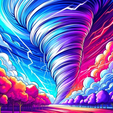
Tornadoes do not always have a visible funnel shape: sometimes, they can be transparent and thus difficult to detect without the help of specialized radar equipment.
Although tornadoes are associated with powerful storms known as 'supercells', less than 30% of supercells actually produce a tornado.
Canada ranks second in the global standings for the countries experiencing the most tornadoes each year, behind the United States.
In case of an alert, seek shelter immediately inside the sturdiest building possible, preferably in a room away from windows and on the lowest floor, ideally in a basement. Protect your head and neck, stay informed through the radio or your smartphone, and do not attempt to observe or film the phenomenon outside.
Intense heat followed by a sudden influx of cold air, high ambient humidity, and violent thunderstorms accompanied by fast-moving storm cells, particularly in the form of supercells, are reliable indicators of a high risk of tornado formation.
Some studies suggest that climate change could influence the frequency and intensity of tornadoes by increasing the thermal energy available in the atmosphere. However, the direct relationship between climate change and the precise frequency of tornadoes remains complex and is still the subject of ongoing research.
The precise trajectory of a tornado is difficult to predict, as it depends on many very specific dynamic and local factors. However, meteorologists are able to accurately identify at-risk areas by anticipating the formation of severe storms through the analysis of satellite and radar data.
A tornado is a rapidly rotating column of air in contact with the ground, typically forming over land, while a waterspout occurs over a body of water. Although similar in appearance and intense rotation, waterspouts are often less destructive.

No one has answered this quiz yet, be the first!' :-)
Question 1/5